Kilimanjaro’s Quiet Northern Approach
The Rongai Route is the only trail that ascends Mount Kilimanjaro from the northern side, near the Kenyan border. It is known as one of the easiest and quietest routes, with a high success rate and more solitude compared to the busier southern approaches.
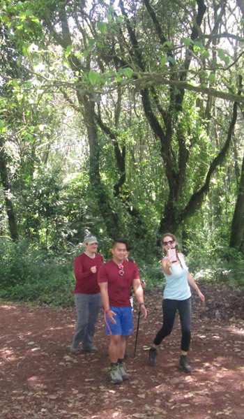
The trail starts in the north, where conditions are drier, making the first day less muddy than other routes. Climbers trek through fields and pine forests before reaching the moorland and alpine desert zones, with spectacular views of Mawenzi Peak, Kilimanjaro’s second-highest summit.
An acclimatization day at Mawenzi Tarn ensures better adaptation before tackling the final push across the Saddle to Kibo Hut and on to Uhuru Peak. The descent follows the Marangu Route, giving trekkers the chance to experience Kilimanjaro’s lush rainforest on the final day.
.
Rongai Route Highlights
Duration: 6-7 days
Accommodation: Camping
Difficulty: Moderate
Scenery: Forest, Alpine Desert, Glaciers
Best For: Hikers seeking a quieter route with high summit success rate
.
Rongai Route Itinerary (7 Days)
Day 1: Rongai Gate (1950 m) – Rongai Cave Camp (2600 m)
Trekking Time: 3-4 hours
Distance: 7 km
Altitude Gain: 650 m
After registering at Marangu Gate, drive to Rongai Gate and begin the trek through farmland, pine forest, and gentle trails. Overnight at Rongai Cave Camp (2600 m).
.
Day 2: Rongai Cave Camp (2600 m) – Kikelewa Cave Camp (3600 m)
Trekking Time: 6-7 hours
Distance: 9 km
Altitude Gain: 1000 m
Climb steadily toward Second Cave, then continue to Kikelewa Cave Camp. Expansive views of Kilimanjaro’s summit open up as the landscape changes to moorland.
.
Day 3: Kikelewa Cave (3600 m) – Mawenzi Tarn (4330 m)
Trekking Time: 4-5 hours
Distance: 7 km
Altitude Gain: 730 m
A short but steep climb brings you to Mawenzi Tarn, set dramatically beneath Mawenzi Peak’s towering spires. The afternoon is free for rest or exploration.
.
Day 4: Acclimatization at Mawenzi Tarn (4330 m)
Spend a full day at Mawenzi Tarn to acclimatize. Optional short hikes are available for those who wish to explore, but rest is key to preparing for summit day.
.
Day 5: Mawenzi Tarn (4330 m) – Kibo Hut (4750 m)
Trekking Time: 5-6 hours
Distance: 8 km
Altitude Gain: 420 m
Cross the wide, barren Saddle between Mawenzi and Kibo to reach Kibo Hut (4750 m). Spend the afternoon resting and preparing for the summit ascent.
.
Day 6: Kibo Hut (4750 m) – Uhuru Peak (5895 m) – Horombo Hut (3720 m)
Summit:
Trekking Time: 6-8 hours
Distance: 7 km
Altitude Gain: 1145 m
Descent:
Trekking Time: 5-6 hours
Distance: 12 km
Altitude Loss: 2175 m
Set off around midnight for the steep climb to Gillman’s Point (5681 m) on the crater rim. Continue for 2 more hours to reach Uhuru Peak (5895 m) — the Roof of Africa.
Descend via the Marangu Route, stopping at Horombo Hut (3720 m) for dinner and overnight.
.
Day 7: Horombo Hut (3720 m) – Marangu Gate (1842 m)
Trekking Time: 5-7 hours
Distance: 18 km
Altitude Loss: 1878 m
The final descent passes through Mandara Hut before reaching Marangu Gate. Collect your summit certificates, meet your transfer, and return to Moshi for a well-earned rest.
.
Pros and Cons of the Rongai Route
+ Pros:
- Quieter and less crowded than southern routes
- High summit success rate
- Dry, less muddy conditions
- Stunning views of Mawenzi Peak
– Cons
- Long drive to starting point
- Less varied scenery compared to Machame/Lemosho
- Forest scenery only at end of trail